
Mapping Northern Ireland's proposed polling places
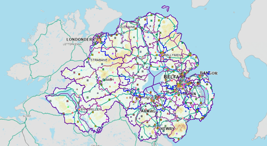
An interactive map of Northern Ireland’s proposed new polling place scheme for next year’s elections is now live for public consultation: check it out!
The map will be available online until 2 October, when the consultation ends.
The Electoral Office for Northern Ireland (EONI) has the largest and most complex responsibilities of any electoral services team in the UK. Democracy Club has been working with EONI for over a year now, providing an online polling station finder, as well as mapping services on a bespoke online platform. The latter has given EONI the tools to organise and manage its polling districts much more efficiently.
We’re very excited to announce that a version of this mapping platform has now been published, featuring proposed polling places for the 2027 elections. As far as we’re aware, this is the first time an entire UK region’s polling place scheme has been publicly mapped out in this way.
Why now?
On 6 May 2027 Northern Ireland will see a rare combined council and Assembly election. This has presented EONI with a challenge: due to the difference between council and Assembly boundaries, each election type has hitherto had its own polling station layout (or ‘scheme’). In many cases, the station a voter attends for an Assembly or UK parliamentary election election is not the same as that they used for the locals. EONI has therefore had to unify the two schemes. Having created a first draft, they are now gathering feedback via a public consultation. The map published today is designed to help people understand the scheme, and inform any modifications they may wish to suggest.
Using the map
The map, which can switch between Ordnance Survey Northern Ireland and aerial photo views, shows the location of polling places and the residential addresses assigned to them. Toggles allow the user to overlay boundaries for council, District Electoral Area (wards) and Northern Ireland Assembly areas (the latter are coterminous with UK parliamentary constituencies). Users can search by postcode, or the name of a polling place. The site is not an anonymised copy of the electoral register; addresses have been included whether or not they contain anyone registered to vote.
When you zoom in, you’ll see that each address is marked in the colour of its assigned polling place, allowing you to understand the boundaries between polling districts. As will become apparent, polling districts are not always neatly divided, but occasionally appear intermingled or non-contiguous. This is not unique to Northern Ireland, and can usually be explained by the landscape on the ground, such as street access. This is why our polling station finder only shows a voter their voting location after they have entered their address: their polling station is often neither their closest, nor that at which their immediate neighbours vote. Due to the availability of suitable buildings, it is not uncommon for a polling place to be sited outside the polling district it serves.
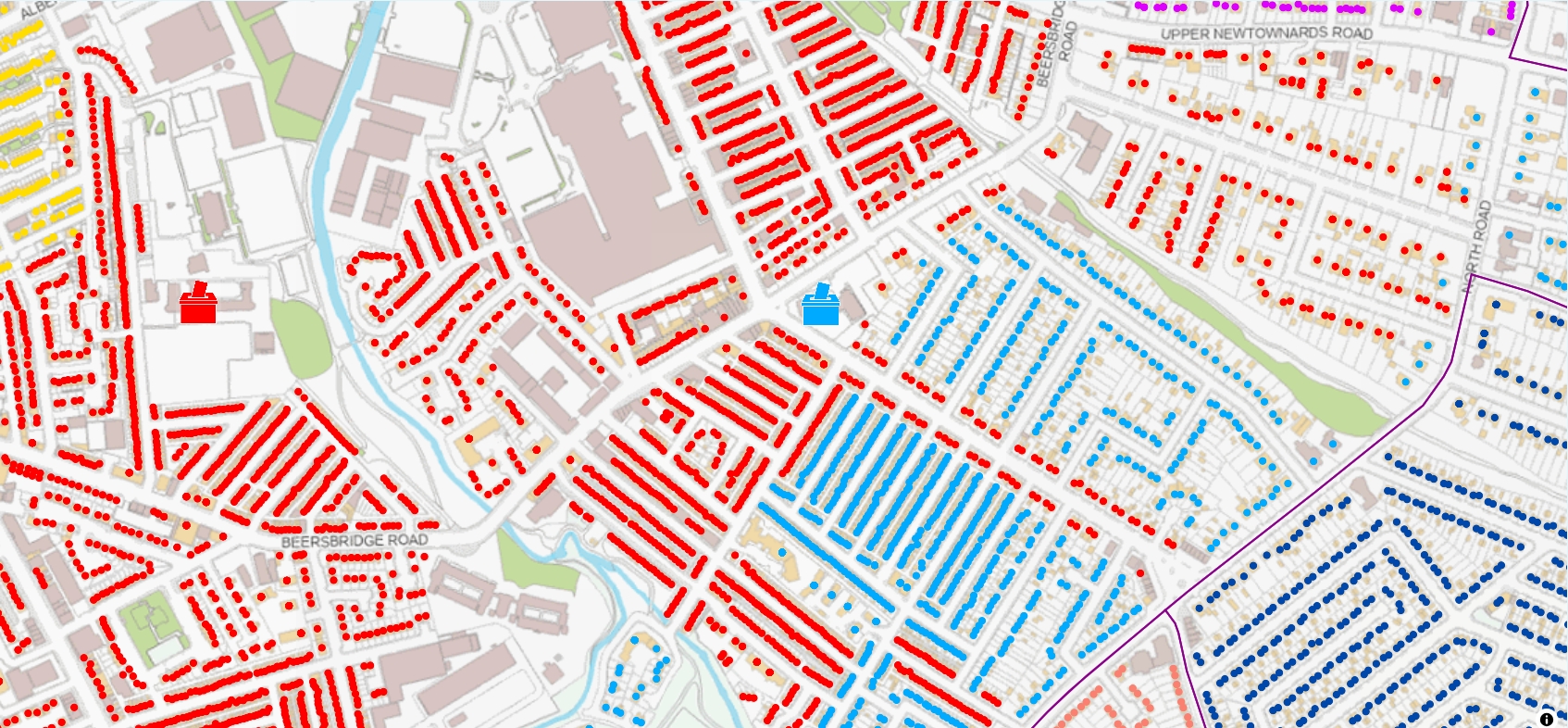
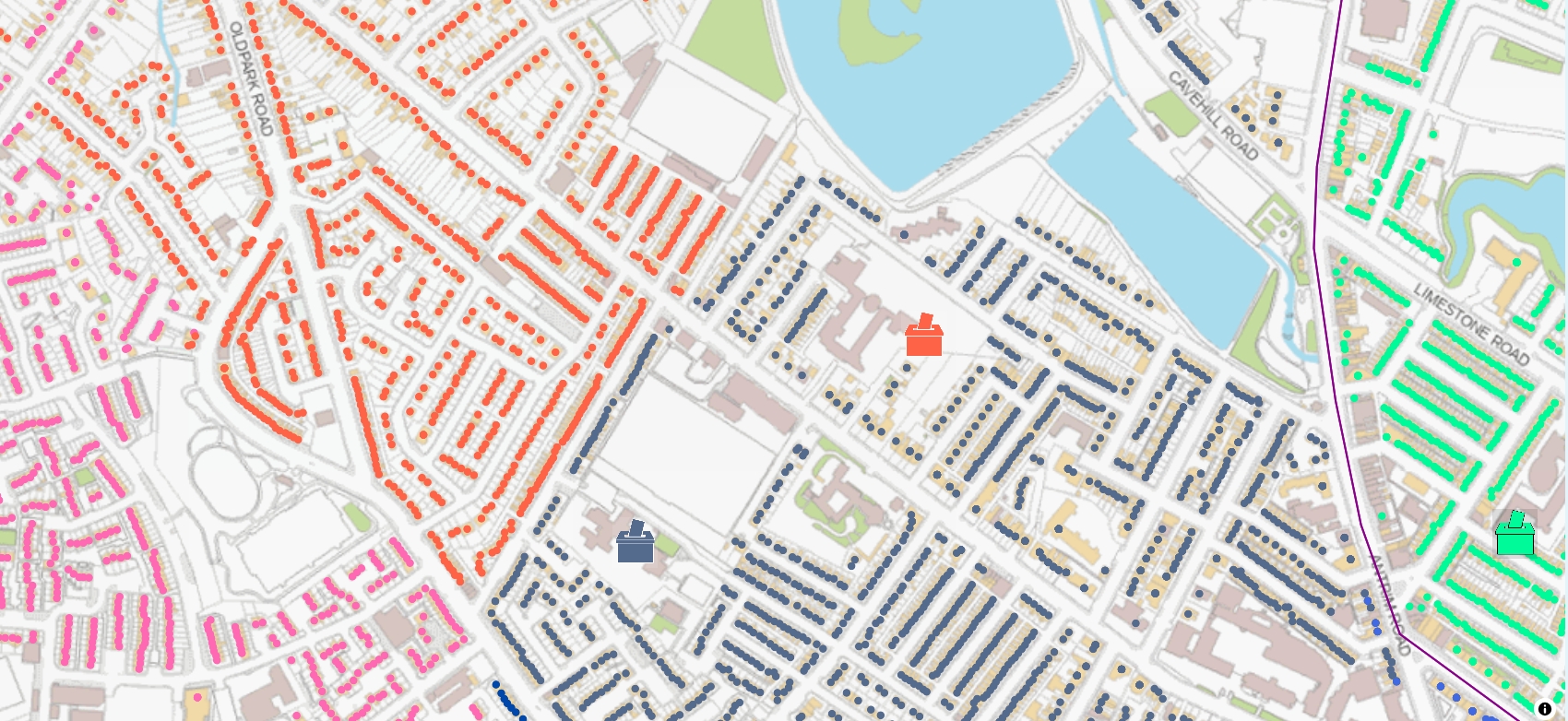
Note that this map depicts polling places, not stations. As we have discussed before, multiple stations and polling districts can be assigned to a single polling place.